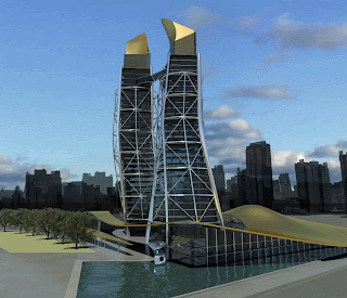
There's a brand-new source of SketchUp salvation on the web. SketchUp Sages is a collection of the very best advice from some of the very best SketchUp modelers. These kind, expert souls have put together a one-stop place to look for all kinds of answers.
Everyone knows that you can "do" 3D in AutoCAD. AutoCAD 2007 made 3D operations, well, feasible in AutoCAD. Before 2007, it was difficult to make simple 3D objects. Many never tried.
After AutoCAD 2007 many were impressed and satisfied with it's 3D abilities. Once I started using 3D in AutoCAD the number one response I would hear was, yeah, that's good, but AutoCAD can't do organic modeling. True. If you needed sharp corners, then it was perfect. Well, now AutoCAD 2010 has provided us with that ability. Once the new free form modeling features hit the design houses and its users can see what it can do now, I wonder what the next complaint will be? Any ideas?
One online resource that is pretty nice is the AutoCAD 2009 cue cards to see a short bite size overview of AutoCAD 2009 features. It is based on Flash and acts like a book complete with turning pages.
With the SketchUp maintenance software that released yesterday, you too can model your very own underwater world! The first thing you'll have to do is to download the latest version of SketchUp here. Once installed, a few simple options in SketchUp enable you to select whether your model is above or below the water:
From joule-counting energy jars to twittering power monitors we’ve got power meters on the brain as of late, what with the upcoming Greener Gadgets Conference and Design Competition. Proving that great minds really do think alike, we’re excited to hear that Google is getting into the energy-saving act with their recently debuted PowerMeter. The application will collect information from utility meters and energy monitors and provide easy access to energy statistics right from your iGoogle homepage. READ MORE
new features include: * Historical Imagery: Until today, Google Earth displayed only one image of a given place at a given time. With this new feature, you can now move back and forth in time to reveal imagery from years and even decades past, revealing changes over time. Try flying south of San Francisco in Google Earth and turning on the new time slider (click the "clock" icon in the toolbar) to witness the transformation of Silicon Valley from a farming community to the tech capital of the world over the past 50 years or so. * Touring: One of the key challenges we have faced in developing Google Earth has been making it easier for people to tell stories. People have created wonderful layers to share with the world, but they have often asked for a way to guide others through them. The Touring feature makes it simple to create an easily sharable, narrated, fly-through tour just by clicking the record button and navigating through your tour destinations. * 3D Mars: This is the latest stop in our virtual tour of the galaxies, made possible by a collaboration with NASA. By selecting "Mars" from the toolbar in Google Earth, you can access a 3D map of the Red Planet featuring the latest high-resolution imagery, 3D terrain, and annotations showing landing sites and lots of other interesting features.
CADspan have released a new version of the plugin that allows 3d printing, and here's a video that explains more:
some of what's new:
* CADspan is now available for both Windows and Mac * It now supports SketchUp 7 (which we released in November) * File processing times are about 10x faster * The system is much more reliable (hooray for beta testing!)
1001bits tools is a collection of shareware plugins (Ruby scripts) for Google Sketchup that are dedicated for architectural works.
Imagine...create 3d models of staircases, spiral staircase, escalators, walls, doors and windows, and even self-generated roof rafters, by keying in the parameters, dimensions, then with a simple mouse click --> they're done! in 3d!
Passive design is architectural design that eliminates the need for mechanical heating and cooling of a building through the use of smart, time-tested heating and cooling strategies such as natural ventilation, solar heat gain and solar shading and efficient insulation. Around 15,000 passive houses have been built around the world in a few short years, yet few are cropping up the United States. Scandinavian and German-speaking countries are sweeping the industry and streamlining the modern family’s heating bill in the process. Passive homes seem to be the next logical step in, well, logical design - German Bauhaus style coupled naturally with Scandinavian modernism, later exploding into what we now know as mid-century modern. Now with 2009 well underway, the world’s budding designers are leaning on the shoulders of sustainability, while passive design is planting its feet in the homelands of Alvar Aalto and Ludwig Mies van der Rohe.
With 360Cities.net you can embed panaoramas into a blog. The company, registered in the Netherlands, is dedicated to promoting geo-mapped, VR panorama photography and VR photographers around the world. Aimed at creating a unique global network of members who are specialists in VR photography their viewing platform is notably feature-rich. For example, it is easy to embed your panorama directly in a blog after uploading. The example of the London Eye below is by Tom Mills, an international panoramic photography award winner, Tom's work has been exhibited in England and France.
With ARplug-in, Google Sketch-Up users are allowed to visualize their 3D models directly in the real physical space which sorrounds them. In a very precise sense, through ARplug-in, Sketch-Up 3D models can be visualized out of the digital workspace directly on users' desktop, by connecting a simple webcam and by printing a suitable code. The Plug-in provides users with an advanced visualization functionality which serves two main purposes:
Study and analize scaled virtual prototypes in real environments
Communicate 3D projects immersively and astonishingly
If you are looking for a free file hosting service where you can store your data so that you can access it from anywhere anytime you like then here's some of the most widely used file hosting services on the internet today. It's up to you to decide which one you want to go with.
Learn how to take models that were created in Revit® or AutoCAD® and import them into Autodesk® 3ds Max® Design to create accurate and compelling daylight simulations with the Exposure™ feature. This white paper is for the daylight simulation novice.
Learn about advanced concepts in daylight simulation using the Exposure™ feature in Autodesk® 3ds Max® Design. This white paper is for architects, designers, engineers, and visualization specialists who are familiar with daylight simulation and want to take it to the next level.
Google has introduced voice and video chat from gmail. All yo need is a plugin which can be installed from within Gmail.
You can view the videos in the small fly-out panel or pop-em out to a large PIP view. You can even blow them up to full screen and have a smooth chatting experience at the same time.
Below is a video tutorial highlighting some of the features of this new service along with instructions on how to use them.
This Episode by the sketchup show, shows you how to use the Virtual Environment - Energy Analysis Plugin from Integrated Environmental Systems (aka: IES VE). You can download this free plugin for SketchUp from the IES Website: www.iesve.com. The Plugin allows SketchUp users to conduct energy analysis simulations of their SketchUp models at the earliest stages of design, which will hopefully help us all to design buildings that will be more energy efficient, reduce energy consumption and ultimately keep Earth from melting.
The Google Earth plugin imports a black and white satellite imagery into skecthup. This episode (#52) by the skecthup show shows how to import sattelite imagery and terrain from google earth in COLOUR. The Episode is a continuation of Episode #51.
You can browse 3D Warehouse models in Google Earth! Clicking this 3D Warehouse Community network link launches Google Earth and shows icons wherever geo-located models have been placed in the 3D Warehouse.
Synchro is a 4D (3D + scheduling) application that allows you to create and see the construction schedule of your project -- all at the same time. They've created a plugin for SketchUp and have full support for the SKP file format. The plugin allows you to bring geometry from SketchUp into Synchro with a unique ID attached to each component. This gives users the ability to make changes in their SketchUp models and port those changes back to Synchro while iterating on designs.
Below is a video representing the product in action provided by Construction Software Advice: